

1 Introduction
1.1 History
The idea of locating with a drawing the various explored, known or even imagined places is actually a very old one. Without the aid of any accurate measurements, Babylonian maps already described rather small areas (Fig. 1).
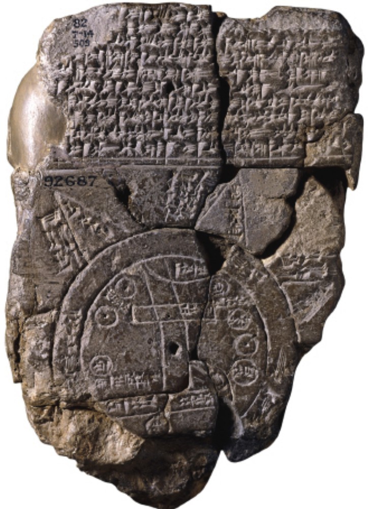
Babylonian map of the World.
The idea that the Earth is spherical is a very ancient one. Lunar eclipses cannot, after all, be understood in any other way. It seems that Anaximander tried to make a map of the World. Herodotus described the countries of the Near and Middle East, but without mapping them. Pythagoras was the first man to state unequivocally that the earth was spherical. Aristotle himself, after making daily observations, came to the same conclusion.
Erathostenes (276–174 BC) can be credited with the invention of geography, since he created the word for it. He noted that Alexandria and Swenett (now Aswan) are located on the same meridian. The simultaneous observations (at noon on the day of the summer solstice) of the projected shadows in both places allowed him to determine the angle under which the distance between the two locations could be seen from the Earth's centre. The calculation of that angular distance by Eratosthenes is only slightly different from today's one. Eratosthenes's map of the inhabited world (called the ecumene) was the accepted one for a very long time (unfortunately no copies survived).
Hipparchus (188–120 BC), the great Greek astronomer, in his critical treatise on Eratosthenes’ geography, described astronomical methods for the determination of the latitude and longitude of geographical locations (by using the time of these observations). He pioneered the stereographic projection for extended mapping.
Strabo (57 BC–25 AD) made very important contributions as well. His Geography is indeed fascinating, and he left to posterity the contributions that Hipparchus had made to the understanding of latitude and longitude and also the expeditions of Pytheas of Massalia.
At that time, Alexandria was the scientific centre of the Mediterranean world. Ptolemy's (90–165) Geography was a continuation of Hipparchus’ works. In particular, he mapped areas that had already been explored (see Fig. 3), especially the Mediterranean, that he described as extending as far west as El Hierro Island (one of the Canary Islands).

The map of the “ecoumenos” of Ptolemy, as redrawn in 1482.
The Greek and Alexandrian heritage was somewhat forgotten in the Middle Ages. For example, the maps produced in monasteries depicted the universe symbolically as a flat circle divided into four equal parts: in the top left section, one found Europe (Europa), in the lower left one, Africa, while Asia itself comprised the entirety of the right-hand side of the map. Major rivers (the Volga and Nile) and the Mediterranean Sea served as markers to separate the continents; Jerusalem, quite naturally, was to be in the centre (Fig. 2). Other more sophisticated but just as broadly outlined depictions were made of the world, as it was known at that time.
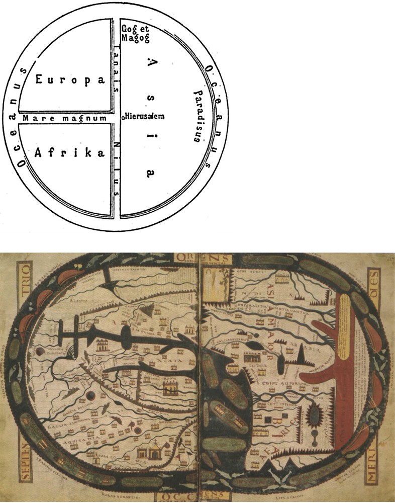
Medieval views of the World. On the top, schematic view (Wikipedia), as described in the text. Bottom: Mapa Mundi, by Beatus de Liebana, as kept in the Saint-Severn manuscript. The orientation differs by a quarter of a circle from the top drawing.
Ptolemy's maps (Fig. 3) were redone and improvements were made. At last in 1570, the Flemish cartographer Abraham Ortelius made a rather satisfactory map (Fig. 4) of as much of the world as had been explored up until his time. The way was now laid open for a detailed and precise cartography of the Earth (Lévy, 2004), and especially of the Mediterranean, which is the subject of this short historical note.
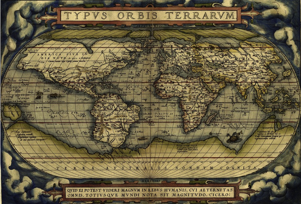
The Abraham Ortelius's planisphere, in 1570.
1.2 The principles of map-making
Making a map requires knowledge of the longitude and latitude of each city, each harbour, each islet… The question of determining latitude was not particularly difficult, as this could be done by observing the elevation of the polar star above the horizon. This made it possible to determine directly the latitude of any location, in comparison to a reference parallel circle that had been well-known for a long time, the Equator (the measure of the elevation of the polar star above the northern horizon allows one to measure directly the latitude of any location).
But determining longitude, however, presented severe difficulties (Raynaud-Nguyen, 1985). There was no meridian circle that could be used as an “origin (or reference) meridian”, so one had to be chosen (that of some arbitrary location ‘A’, for example). To get the longitude of a place ‘B’ relative to ‘A’, the same astronomical phenomenon had to be noted at place A at the local time Ta, and at place B at the local time Tb; the difference (Ta–Tb) would give the longitude of B, and thereby the angular difference between the meridian circles could be measured. A simple method – and one already proposed by Hipparchus – was to use a lunar eclipse (Fig. 5), a phenomenon that occurs at the same time everywhere on Earth, wherever it can be observed.
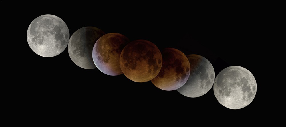
The lunar eclipse of September 2015, 28th.
Photograph by Philippe Morel.
Astronomers could, without too much trouble, measure a distance on the Earth (as a number of steps or wheel revolutions), both south to north and east to west, but what when at sea? Moreover, whether ashore or at sea, it was necessary to determine the difference in solar time of a specific astronomical phenomenon at place A from the solar time at which the same phenomenon could be observed at place B. Modern clocks can be carried around easily, but the gnomons of ancient times could not!
This technique did not, however, facilitate the making up of a geographical map, because units of length that can be easily inferred from a difference in latitude are not so easy to infer from a difference in longitude (length units being much larger for a low latitude than for a high latitude). The astronomer-geographer (for instance for France or the Mediterranean area) had to make a precise computation corresponding to a longitudinal difference at a given latitude. In order to draw maps of a larger latitudinal extent, it is necessary to project the sphere on a plane, an operation for which several well-known options do exist (not described here).
At the end of the 16th century, the invention of refracting, and then reflecting, telescopes enabled the viewer to get a much better view of dim and distant objects. This is why, in the early 17th century, Galileo's use of his refracting telescope (which he did not invent, but improved greatly) allowed him to discover in the sky hitherto unknown objects (Fig. 6). Other astronomers, especially in Germany, followed his lead.
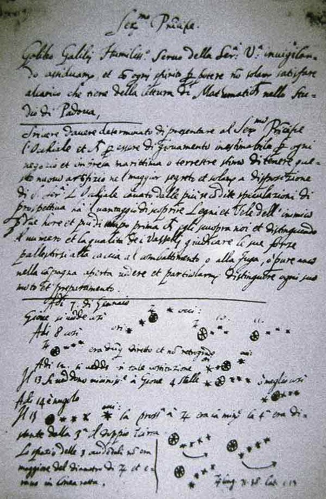
The discovery of Jupiter's satellites. Draft of Galileo's letter to Leonardo Donato, Venice's doge. The bottom part of the folio shows the use by Galileo of his telescope, in 1610: as he looked at the sky, he noted his early observations of Jupiter and of three of his satellites.
Later on, improvements were made on these instruments: the use of telescopes installed on “quarters of circle” used in astronomy and geodesy, the invention of the micrometre, which increases the accuracy of angular measurements. One should also mention the improvements made by Huyghens (circa 1665) on the mechanism of clocks, the best of which (circa 1673) never varied by more than a second per day (Fig. 7). One should remember that in astronomy the accurate measurement of time is of equal importance as the accurate measurement of angles.
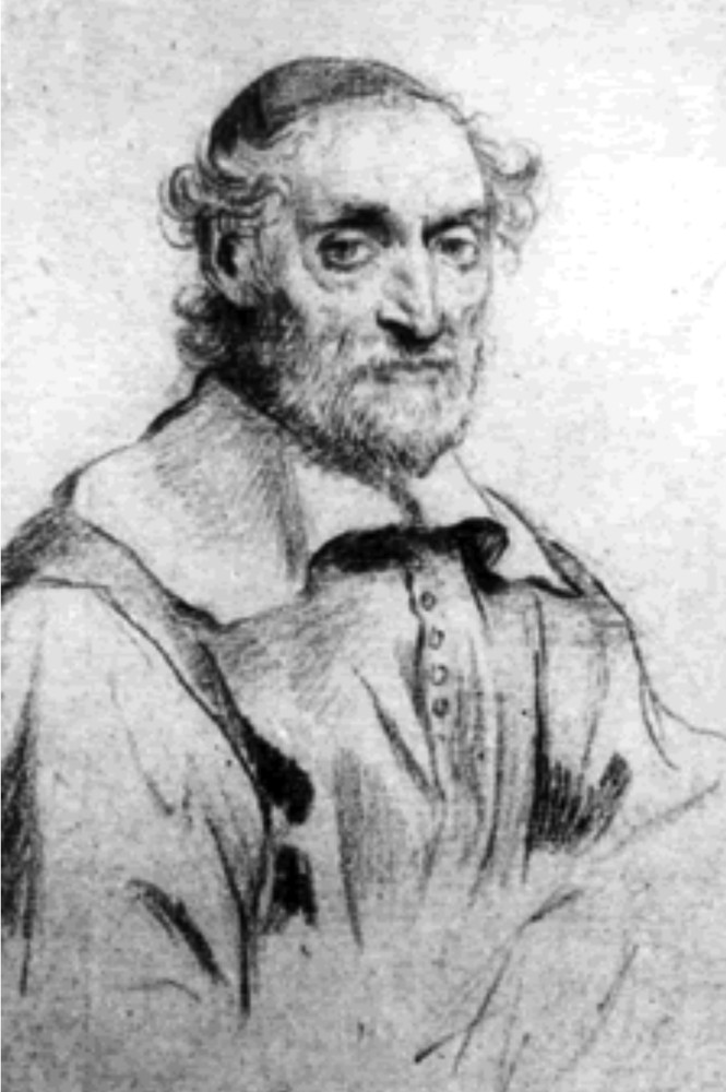
Claude Nicolas Fabri de Peiresc.
1.3 French explorations around the Mediterranean during the 17th century
1.3.1 First half of the 17th century
On 7 January 1610, Galileo discovered three heavenly bodies near Jupiter; after a few days, he noted that they revolved around that planet and discovered a fourth one (Fig. 6). He named them the ‘Medici’ (his protector's name), and he published his discovery in his Sidereus Nuncius on 12 March 1610. At about the same time, others made the same discovery, but Galileo was the first one to publish his.
The news reached Nicolas Fabri de Peiresc (Gassendi, 1992) (Fig. 7) on 3 June 1610, in a letter written to him by Pigniora, an expert in antiques whom he had met in Padova during one of his Italian trips. Fascinated by this discovery, he bought several telescopes (of the refracting type), hoping that at least one of them would be satisfactory, and we can be certain that at least one was, because in November of the same year Peiresc became the first person in France to observe the four satellites of Jupiter. With his friend Gaultier de la Valette, he continued his observations for two years so that he could calculate exactly how long a revolution of the planet took. Peiresc also collected and studied the observations made by Galileo, Kepler and others. Greatly assisted by this knowledge, he came up with the idea of using the rising and setting of Jupiter's satellites as a way of determining longitudes (i.e. the “immersions” and “emersions” of a satellite into and out of Jupiter's shadow). Indeed, if one measures the local times when one of these phenomena occurs in two different locations, the difference of the local times immediately yields the longitude of one location relative to the other. Peiresc sent telescopes to his correspondents in the East, and even had his assistant Jean Lombard go to Aleppo to try out the method – but it failed, most likely because of the absence of reliable ephemerides for the motions of Jupiter's satellites. Peiresc then abandoned this method, convinced that onboard ships could not be used. He then returned to Aix-en-Provence, where he spent most of his time. He nevertheless hoped that Galileo would continue his observations, which indeed he did.
Peiresc had a wide variety of interests, so he only returned to the subject of the determination of longitudes in the Mediterranean area after a period of 25 years, and mostly because he knew that astronomy could be of great use to geographers; he decided this time to use lunar eclipses to determine longitudes. The method was not unknown but it was not at all easy to undertake. The main difficulty in the case of an eclipse of the Moon passing in the Earth's shadow is that, because of its diameter, it is not an instantaneous phenomenon, contrary to the entrance of one of Jupiter's satellites into the planet's shadow (Fig. 5). It was indeed necessary to have observers stationed all around the Mediterranean, noting the local time of the same instantaneous event, for example, the entrance of the Moon into the Earth's shadow, which is rather difficult. However, with the use of refracting and reflecting telescopes and the observation that the Moon's surface was uneven, it was easier to note the instant when the Earth's shadow reached a certain feature of the Moon (for example, the crater now known as “Copernicus”). This is why Peiresc, and even more strongly his friend and protégé Gassendi, wished to have at their disposal drawings or paintings describing the different lunar phases as seen with a telescope. Gassendi, who obtained from Galileo an excellent telescope, noted and drew the different aspects of the lunar relief; in order to get a more detailed representation of the relief, he decided to commission several painters for this purpose. The first was Claude Salvat who, upon his return from Rome in 1635, stayed with Peiresc at his home in Aix-en-Provence. The second painter and engraver (he excelled at both arts) was Claude Mellan. The engravings by Mellan (Fig. 8) were meant to show the precise instant of the entrance of the Earth's shadow onto, for example, a given lunar crater. The project was never completed, and there are only three drawings left: the full Moon, and the two quarters.
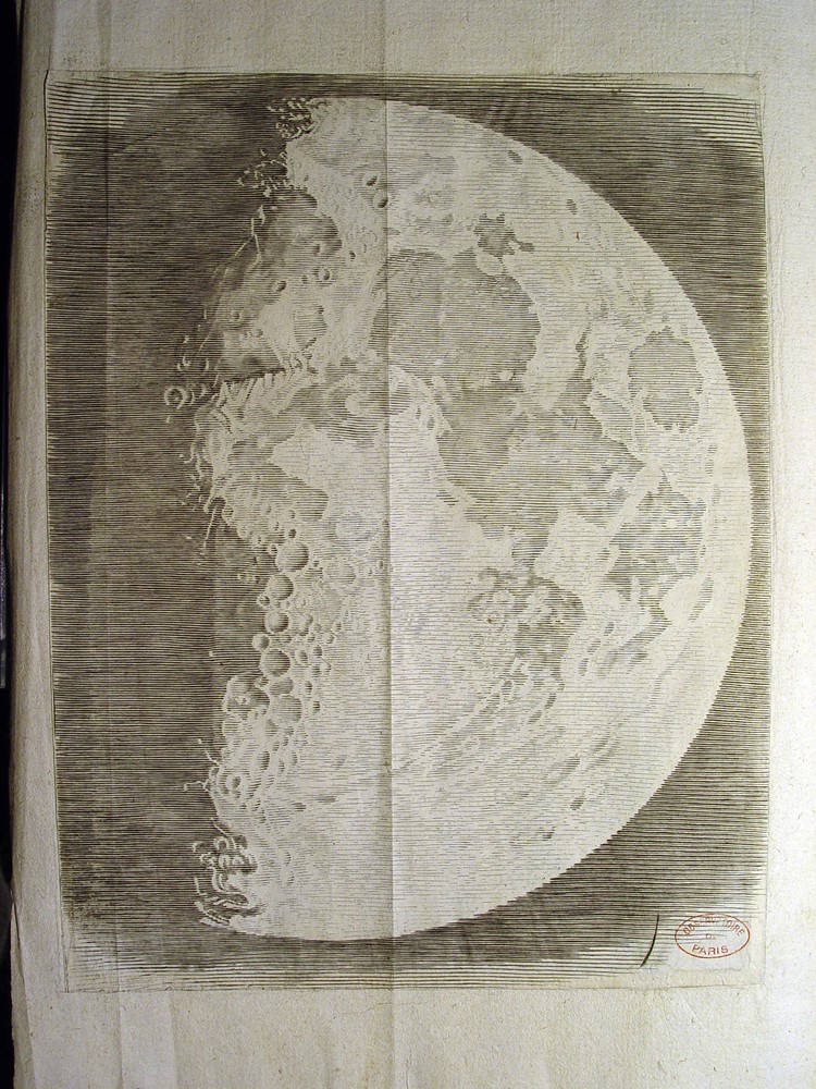
Etching of the Moon's first quarter, by Claude Mellan (1635).
Peiresc then directed the writing of a method to observe the lunar eclipses, one that would enable geographers to get a better determination of longitudes. Thanks to his excellent relations with a wide variety of people around the Mediterranean (in Italy, Cairo and Aleppo; he was a remarkable art collector), he had no difficulty in getting them to send him information (provided by local scientists and friars) about a lunar eclipse that took place on 28 August 1635. With this information, he was able to prove that Aleppo was not approximately three hours away from Marseilles in longitude (i.e. about 45°), which the old maps indicated, but only two hours (i.e. about 30°). Inspired by the success of this method, the spectacular result of which diminished the length of the Mediterranean by at least 15°, Peiresc asked his friend and correspondent Cardinal Barberini – as well as the directors of the religious orders – to get the priests in India to observe lunar eclipses. Because of this tireless and excellent work, Peiresc can probably be considered the initiator not only of lunar eclipse observations, but also of the eclipses of Jupiter's satellites that were carried out by missionaries in Asia, Africa, and America.
1.3.2 Second half of the 17th century
In the year 1668 in Bologna (Italy), the Ephemerides of Jupiter's satellites by Gian Domenico Cassini were published and sent to Auzout, a member of the French Royal Academy of Sciences (which had been created in 1666 and celebrates its 350th anniversary this year). The Paris astronomers, having recognized the great quality of these tables, suggested that principal (“prime”) minister Colbert should invite Cassini to Paris. Cassini accepted the invitation and arrived in Paris in 1669; but he only stayed for a short while and did not make Paris his permanently home until 1673. He was then housed in the brand new building of the Paris Observatory, where he founded a dynasty of astronomers who remained active till the Revolution (Cassini I to Cassini IV).
Thanks to Cassini's Ephemerides, the eclipses of Jupiter's satellites (actually, only the brightest satellite) gave more reliable longitudinal readings than those that came from lunar eclipses, and with them there was the added advantage that, provided that Jupiter was visible, they could be observed almost every day. The method was tested in the South of France (in Sète and Montpellier) as early as 1674 by Abbot Jean Picard. But it was only from 1679 to 1682 that the Observatory's astronomers Jean Picard et Philippe de la Hire were sent to the French coasts, where they accurately determined the latitude and longitude of the main harbours relative to Paris. At the Observatory, Cassini performed simultaneously the corresponding observations.
In 1682, after Picard's death, La Hire was sent to the Mediterranean coasts, where he noted: “Il était très nécessaire d’avoir une exacte position de cette Côte à cause des Ports de Marseille, Toulon & Antibes, qui sont les plus considérables de la Mer Méditerranée, & où séjournent ordinairement les Vaisseaux & les Galères du Roy. C’est pourquoi M. de la Hire reçût ordre de partir dans le mois d’octobre de l’année 1682 pour y aller avec le même équipage qui avait servi dans les autres Voyages ; M. Cassini étant demeuré à l’Observatoire, pour y faire les observations correspondantes à celles qu’on devait faire en Provence.”1 (de La Hire, 1682)
In the same Mémoire, Mr. de la Hire described the observations (meridian heights of stars and some immersions of Jupiter's first satellite into the planet's shadow) he made in Antibes from 2 November to 21 December. He did the same in December in Toulon and Aix-en-Provence. La Hire, as a conclusion to his observations in Antibes, provided the longitudinal difference between Paris and Antibes: 19 m 7 s and/or 19 m 14 s½. In his letters to La Hire, Cassini commented on these results (Cassini, 1682); in his letter dated 23 November 1682, he wrote: “Il ne faut pas s’étonner si la différence des méridiens se trouve plus courte que dans les Cartes puisque toutes les observations que nous avons faites jusqu’à présent montrent que les Cartes dilatent trop les longitudes du continent c’est pourquoi étrécissant de tous côté à proportion nous avons assez bien rencontré dans la carte de l’observatoire.”2 Cassini alludes here to the map of France that had been traced on the floor of the western tower of the observatory, a map established by Chapelles and Sébillot under his own guidance.
Jean Mathieu de Chazelles (1657–1710) was appointed to the ‘Académie des sciences’ in 1695. A professor of hydrography in Marseilles, he was sent to the Western seas in 1689–1690 aboard the king's galleys in order to check the maps of the coasts of Gascony and the Channel. He established and published new maps of these areas in 1692 in the Neptune François. In 1693, Mr. de Pontchartrain, secretary of State for the Navy, expressed the wish to have a second volume published for the Mediterranean. Chazelles then suggested going to the Eastern Mediterranean in order to determine the position of the main harbours (Le Bovier de Fontenelle, 1732). Following the King's command, Chazelles left Marseilles at the end of 1693. His trip brought him to Malta and Cyprus in December, then to Alexandretta (now Iskenderun) in January 1694, and eventually to Egypt. He was in Cairo in March–April, and noted that the four sides of the pyramids faced the four cardinal points. He was in Rosetta and Alexandria from April till June. From Alexandria's harbour, he sent his Egyptian observations to the Academy of Sciences, together with a note in his handwriting: “Envoyé par duplicata par le vaisseau L’Hirondelle party d’Alexandrie le 6 juin 1694” (Chazelles, 1694).3 Chazelles went next to Constantinople (September–October), passing through Rhodes (July), and the Dardanelles (August) before returning to Marseilles. The measurements he made during his trip (the height of the polar star – and some others – above the horizon, the instant of immersion or emersion of Jupiter's satellites), together with corresponding observations made at the Paris Observatory, made it possible for him to determine the latitudes and longitudes of the places he had visited. Later in his career, Chazelles worked together with Père Laval (1664–1728) on the coasts of Provence. Laval brought a map of these coasts to completion in 1720.
1.4 Explorations of in the Mediterranean during the 18th century
1.4.1 First half of the century
Antoine François Laval, a Jesuit, born in Lyons, was appointed professor of hydrography in 1697 in Marseilles (Débarbat and Dumont, 1990). He worked there together with Chazelles on observations of eclipses of the Sun (1706) and the Moon (1708). He set up his instruments in the Sainte-Croix convent, an observatory newly built in 1703 of which he was the first director (and that later became the observatory of the Navy in Marseilles). He was appointed as professor of hydrography in Toulon in 1718 and from there undertook the mapping of the coasts of Provence from May till September 1719. In 1720, he travelled to Louisiana. Once back in Toulon, he observed regularly the eclipses of Jupiter's satellites, the occultations of stars by the Moon, and sunspots. He was particularly interested in two subjects: the refraction of light and sunspots; it must be noted that the work he sent to the Academy was of a very high quality.
Père Feuillée too was sent to the East in 1700–1701, probably to continue Chazelles’ work. His remarks in the ports of call were reported by Jacques Cassini (Cassini II; Cassini, 1702), and he left a record of his travels (the height of the pole, sometimes immersion of the first of Jupiter's satellite). He was in Smyrna from 3 to 28 October 1700; on his way to Thessaloniki, he reported a Moon eclipse on 22 February 1701; he was in Thessaloniki from 7 March to 26 April, in Mile in the Archipelago on 4 June 4, in the Island of Candia and Chania from 20 to 27 June, in Candia in the House of Capuchin monks on 5 July, in Tripoli on 28 July. On his way to Tunis and Algiers, he wrote the following: “il fut insulté par une troupe de Noirs, qui le pillèrent & lui prirent entre autres choses sa pendule, ce qui l’obligea de revenir sur ses pas, & de s’en retourner en France…”.4 In this expedition, Père Feuillée brought instruments similar to the ones used by Chazelles, and therefore their observations were complementary, allowing a good determination of the coordinates of the main ports of call in the Mediterranean. In his conclusion, Jacques Cassini wrote that the observations made by Père Feuillée and Chazelles were of great importance in determining the main locations on the Mediterranean coast east of France.
The work that the French astronomers did in the mapping of France was interrupted by Colbert's death in 1683, and they did not return to the work of establishing the Paris meridian until the end of that century. But it is not until 1733 that they got to work on applying the measurements of the parallel circles and perpendiculars of the Paris meridian to a large grid pattern of France.
In 1738, Cassini III (Cassini de Thury), Maraldi II and La Caille measured the perpendicular from Bayonne to Antibes. Then they measured large triangles as well as a base near Perpignan on the French Mediterranean coast (Fig. 9). Cassini III and La Caille remained in that area for some time in order to carry out experiments between Cette (now Sète) and Marseilles. Maraldi supplemented the measurements made by La Hire from Antibes to Aix in 1782, and in September finished his measurement of triangles off Antibes, and then went back northward along the border.
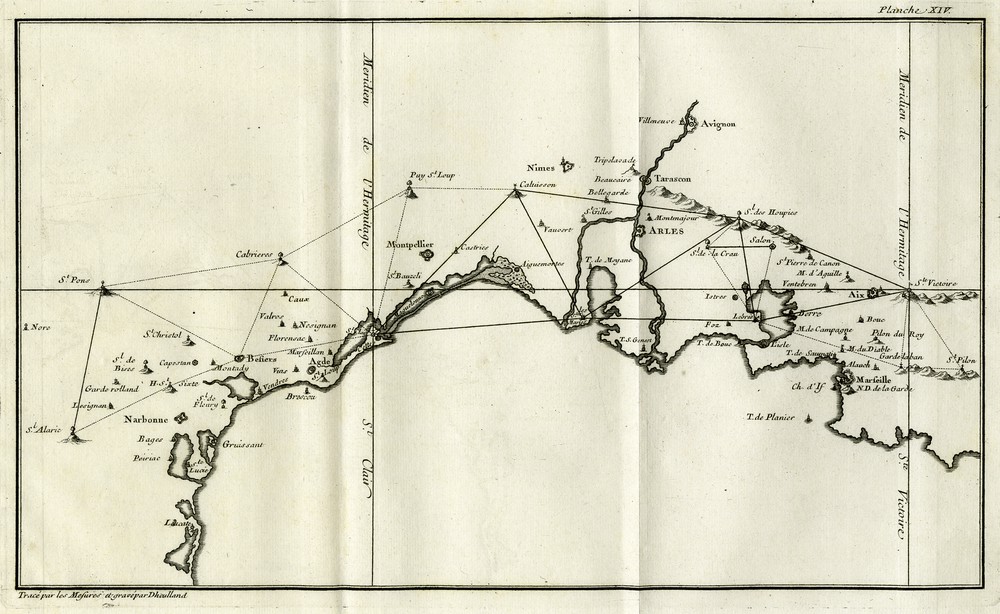
Map of the triangulation achieved along the Mediterranean coasts, according to La méridienne de l’Observatoire Royal de Paris, vérifiée dans toute l’étendue du Royaume par de nouvelles observations (Cassini de Thury, 1744).
Charles Marie de la Condamine (1701–1774) began his professional life in the military, but he very quickly abandoned it for science, and in 1730 received an appointment to be an Assistant Chemist at the Academy of Sciences. But he was eager to travel and in 1731 he obtained a king's order to join a ship in a squadron on the way to the Ports of the Levant that was commanded by Duguay-Trouin. He wrote (de La Condamine, 1732): “La curiosité seule ne m’aurait pas inspiré le dessein de ce voyage. Le principal but que je me proposais était de m’instruire sur la Navigation, & de chercher à faire en des lieux peu fréquentés des Physiciens, quelques observations utiles au progrès de la Géographie & de l’Histoire naturelle.”5 His mémoire was not a travel log but rather a collection of notes and observations he made on various topics. On the subject of geographic coordinates, he wrote that there was no significant difference between his own measurements and the tables that appeared in the publication Connaissance des Temps. In the “Palais de France” in Constantinople, his measurement of latitude corresponded perfectly with that of Chazelles. He wrote much about navigation, about the very defective charts drawn after pilots’ logbooks… In the Levant, he noted that inoculation had been practised for a long time.
In 1741, Père du Chatelard, a Royal hydrographer at the port of Toulon, spent April and May in Constantinople (like Chazelles 47 years earlier), and, near the “Palais of France”, he observed, for the calculation of latitude the meridian height of the Sun, and for longitude, on 1 May, the emersion of the first of Jupiter's satellites. From three similar measurements taken at the Paris Observatory by Maraldi, the instant of that emersion in Paris could be deduced and then the longitude of Constantinople relative to Paris could be obtained. He found 1 h 51 min 30 s, i.e. 27° 52′ 30′′. This result is off the value given in Connaissance des Temps that were based on Chazelles’ observations by 1° 29′ 00′′.
1.4.2 Second half of the 18th century
Twenty years later, La Caille examined Chazelles’ observations and the various notes in the Academy's library. He undertook to rework these reductions using tables that had been updated and were superior to the ones used by Chazelles: table of the Sun (La Caille) of 1750, tables of star declinations from La Caille's catalogue (1760), table of refractions (1755) and tables of Jupiter's satellites by Wargentin. He was thus able to determine that Constantinople's longitude was equal to 1 h 46 min 25 s, i.e. 26° 36′ 15″, instead of 26° 33′ 30″, which was Chazelles’ previous result. La Caille noted: “M. de Chazelles fait pour le mieux selon les lumières de son temps & selon les instruments qu’il a employés ; ce qui résulte de son voyage, c’est-à-dire, la détermination géographique des lieux où il a séjourné, me paraît d’une exactitude suffisante pour la Navigation, & même pour faire usage des observations astronomiques faites par les Anciens. Il est vrai qu’un Observateur de notre temps pourrait mettre un peu plus de précision ; on pourrait donc regarder un nouveau voyage dans ces pays-là comme fort utile pour confirmer les observations de M. de Chazelles, sur-tout si on y ajoutait de nouvelles faites sur la côte de Syrie & de Barbarie, dont nous sommes presque entièrement dépourvus.”6 (‘Barbarie’ stands for northern Africa).
This declaration substantiated proposals made by the Marquis de Chabert, who published his first observations on the Mediterranean in 1762. Chabert, a naval officer, had studied astronomy, and, thanks to some observations of the eclipses of Jupiter's satellites, he was able to correct the longitude of the coasts of Acadia (Canada) in 1750–1751. Once his project for the rectification of the Mediterranean coasts had been approved, he began in 1753 some work in Cartagena, but this was disrupted by the Seven Years’ War (1756–1763). In 1756, after the capture of Fort St Philipat at the entrance of Port Mahon in Minorca, the Count de la Galissonière returned to France with the army and let Chabert “rester en croisière aux environs de Minorque avec L’Hirondelle qu’il commande”.7 His observations near the Fort in December 1756 and in April 1757, together with Maraldi's corresponding ones at the Paris Observatory, allowed him to determine its longitude: 5 min 54 s. He then went to Larnaca on the island of Cyprus, and returned there again in 1762 (Chabert, 1762). In 1759, he gave a speech at the Academy on his project of making astronomical and hydrographical observations in the Mediterranean in order to establish a set of maps with a portolan, entitled Neptune françois, second volume (the first one in 1692 was Chazelles’).
At the conclusion of the war, Chabert undertook further explorations of the Mediterranean. In 1764, he travelled to Barbary and made calls in Algiers, Oran, Tunis and at the Port of the Bomb in the Barca region. In Cagliari in Sardinia and in Malta, he observed the eclipses of Jupiter's satellites, and was able to establish longitudes thanks to the corresponding observations made by Wargentin, Hell, d’Arquier and Messier (Chabert, 1766). He intended to go east of Tripoli and probably as far as Egypt. In 1766, he began to visit Cap Corse and several islands off the Italian coast. He next went to Tunis and, after having obtained a sea-brief, he explored Tunisia's eastern coast with a Bey officer. Despite these precautions, he still could not land. He stayed for two days off the coast of Sfax and he almost had his throat cut when on land in front of the castle of Birban, so he had, perforce, to determine its latitude from the safety of his ship. In Tripoli, he was welcomed by the Pasha and was allowed to set up a tent, which provided sleeping quarters for him as well as a shelter for his observatory. In September, he sailed along the coast to Benghazi, and then got caught in a storm that caused such damage to his ship that he was forced to sail to Malta for repairs. Once the ship was seaworthy again, he explored Sicily, the Gulf of Tarento, and returned to Toulon on 26 January 1767 (Chabert, 1767).
Ten years later, Chabert made two transatlantic journeys (1778–1779 and 1781–1782), during which he tested the timepieces that he used in the Cyclades archipelago in the Mediterranean to rapidly determine longitudes (Chabert, 1783). What happened to Chabert's notes and observations? In his Histoire de l’Astronomie for the year 1783, Lalande writes (Lalande, 1803): “Méchain travaillait à la rédaction des observations et des journaux de voyage de Chabert pour faire une nouvelle carte de la Méditerranée…”.8 This work was interrupted in 1792 because of Chabert's emigration to England. Several bibliographies mention an Atlas général des côtes de la Méditerranée9 by Marquis de Chabert, 1791, but it was most likely lost “during the French Revolutionary turmoil”.
Other travellers made astronomical determinations in the Eastern Mediterranean, one of whom, the Abbot de Beauchamp (a student of Cassini IV in 1780 at the Observatory of Paris and of Lalande at the Royal College), left France for Baghdad with his uncle, after the latter had been appointed bishop of Babylon. From 1781 to 1790, Beauchamp sent, first to Cassini IV and then to Lalande, some observations he had made in Aleppo (where he stayed for a year) and then in Baghdad. At Lalande's request, he went to the Caspian Sea in 1787 in order to observe a lunar eclipse. But the funding he received for his work was abruptly cancelled when the French Revolution began, and he was thus compelled to return to France. But with Lalande's encouragement, he left again in 1796 in order to serve as a Consul of the Republic of Muscat on the Arabian Peninsula. Once in Constantinople he was allowed to explore the southern coast of the Black Sea, but afterwards the events in France obliged him to change his route and he was ordered to join Bonaparte's expedition in Egypt, where he was appointed to the Institut de France and worked for a while with the astronomers of the expedition, Nouet and Méchain (the elder son). Bonaparte then sent him on a mission to Constantinople, where he was taken captive by the English who then handed him over to the Sultan, and in whose prisons he was held for three years. When he was finally released, he fell ill and he died upon his arrival back in Nice.
The astronomers who accompanied Bonaparte to Egypt determined some positions there, on the Mediterranean coast, and in Cairo; and following in the train of Desaix’ division to Aswan, they carved their names (Nouet, Méchain…) inside the Temple of Isis on Philae Island together with its longitude and latitude. The temple had to be moved in the 1970s, in order to be saved from the waters, but this geodesic data retains the memory of its former location.
2 Conclusion
In the late 17th century, astronomy provided new methods for the determination of the Earth's longitudes. The meticulous observation of the eclipses of the four Galilean satellites of Jupiter (mainly the brightest and nearest one to the planet, which provides the largest occurrence of eclipses) allowed scientists to accurately locate towns and ports and other places almost everywhere on Earth relative to the Paris meridian, which at that time was France's origin meridian. The observations of these eclipses were still being used in the 19th century to correct maps.
In the 17th and 18th centuries, astronomers also invented methods to accurately determine longitudes onboard ships. They were based, for example, on measuring the distances of some stars and the Sun from the Moon, a method that would have been impossible without reliable lunar tables (for instance, La Caille's ones) and exact calculations. An easier method was to use, for example, the clocks or timepieces that were developed by Harrison in the second half of the 18th century and that were very commonly used in the 19th century. A timepiece onboard recorded the time of a specific place (the departure port for instance). One only had to determine the local time (this is where astronomy played such an important role) on the boat and the difference between it and that provided by the timepiece in order to determine the difference of longitudes between the ship and its point of departure.
Nowadays, thanks to Earth's man-made satellites, the measurement of longitudes (actually of the coordinates of any location) has become so sensitive and accurate that one can even regularly follow the progress of continental drift.
Acknowledgements
The author wishes to express her gratitude to Suzanne Débarbat for her careful reading of the manuscript, to Émilie Kaftan for her research on the figures, and to Monique Wonner and David Reney for their precious help in the translation of the French manuscript into English.
Simone Dumont, winner of the 2015 Doisteau-Blutet prize of the Academy of Sciences, was invited to contribute this paper by CRG's chief editor Vincent Courtillot. The paper has been reviewed by Jean-Paul Poirier and Vincent Courtillot.Funding: FACAD.
1 “It was very necessary to get an exact position of that coast, because of the harbours of Marseilles, Toulon and Antibes, which are the most considerable of the Mediterranean sea, and where the king's ships and galleys generally remain. This is why Mr. de la Hire was ordered to go, during the month of October, 1682, with the same crew who had served in the other trips. Mr. Cassini stayed at the Observatory, in order to perform observations corresponding to those which were planned to be performed in Provence.”.
2 “One should not be astonished if the difference between meridians is shorter than in the maps, as all the observations which we performed until now show that the maps are too much increasing the continent's longitudes: this is why, by shortening all coasts in proportion, we have well accounted for that in our own map of the Observatory.”.
3 Sent in duplicate, on board the ship Hirondelle, which left Alexandria on June 6th, 1694.
4 “He was insulted by a group of Blacks who plundered him & took away his clock among other things, which compelled him to turn back & go back to France.”.
5 “Sole curiosity would not have inspired the scheme of that journey to me. The main purpose I laid upon me was to learn about sailing & to make some useful observations for the progress of Geography and natural Sciences in places which are seldom visited by physicists.”.
6 “Mr. de Chazelles does his best according to the available knowledge at the time & to the instruments he used; the result, that is geographical determination of places where he stayed, seems accurate enough to me for navigation purposes & even to use astronomic observations as made by the Ancients. The fact is that an Observer of our time could report more accurately…; therefore a new journey to those countries could be considered as highly useful to confirm Mr. de Chazelles’ observations, especially if new ones could be added on Syria and Barbary coasts, which we are almost entirely lacking of.”.
7 “Cruise around Minorca on the Hirondelle he commands.”.
8 “Méchain was working on the writing of Chabert's observations and travel diaries to make up a new mapping of Mediterranean Sea…”.
9 General atlas of Mediterranean coasts.